
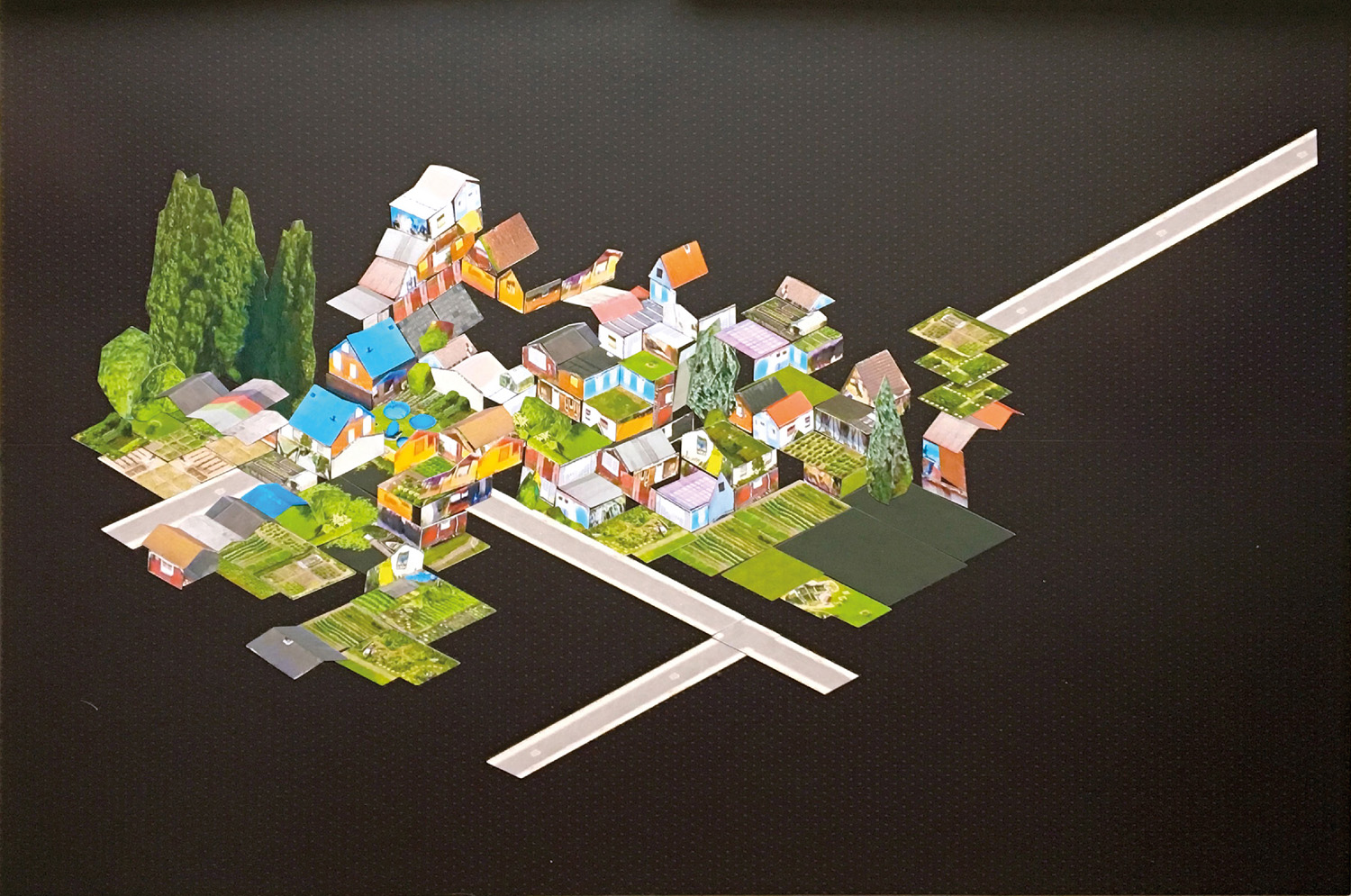
Low Res City – Mixmaps, Y5. Tutors: Prof. Laura Allen and Prof. Mark Smout. In times where cities become factories of data, run by ‘smart’ algorithms, gaming and augmentation might become critical tools for a new urban vernacular. Can the data they produce become play resources of the future? Not algorithmically computed but played with, datasets can be empowering, creative tools that foster a shift of perspective. Planes fitted with high resolution cameras are used by Google and Apple to make three-dimensional scans of cities' surfaces. The accumulated data is accessible through apps provided by the companies, such as Google Maps, that don't allow any other interaction with it. I warped aerial photogrammetry mined from Apple Maps screenshots of my site in Hamburg into isometric projection: part of a coherent projection method, and split into components, a sterile dataset become 'Mixmaps' – a tool to reimagine, repurpose and reconfigure spaces and materials found on site.


